How does a magnetometer work in a satellite?
January 26, 2025
Advantages of using lithium-ion batteries in satellites
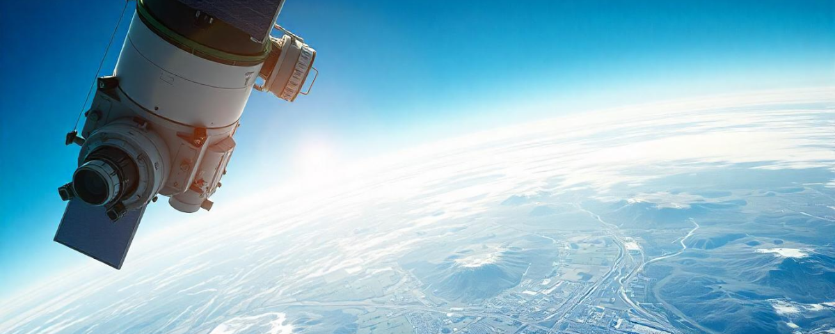
January 26, 2025Optical satellites are like special cameras in space that can see things humans can see and a bit beyond. They use sensors to capture pictures of Earth, and these pictures are incredibly useful for many things. For example, they help us monitor the environment, respond to disasters, plan cities, and improve farming. This essay will explore how these space cameras are used in many different ways and how they help us solve important global problems.
-
Mapping What’s on the Ground
Optical satellites are great for creating maps that show what covers the land. By looking at how different things on the ground reflect light, scientists can figure out what’s there – like forests, lakes, and cities. This information is very important for:
- Keeping an Eye on the Environment: Tracking how forests are disappearing, deserts are growing, and cities are expanding helps us understand how the environment is changing and how this affects plants and animals.
- Improving Farming: Monitoring the health of crops, finding areas with drought or disease, and estimating how much food will be produced helps farmers grow more food efficiently.
- Planning Our Cities: Understanding how cities are growing, finding areas that need development, and figuring out what infrastructure is needed helps us build cities in a way that is good for everyone.
-
using Optical satellites for Helping After Disasters
Optical satellites are very helpful when disasters happen. They can quickly give us a big picture of the damage. After things like earthquakes, floods, and wildfires, satellite images can:
- See the Damage: Quickly find places where buildings, roads, and plants have been badly damaged.
- Guide Help: Show rescuers and helpers where they are most needed.
- Track the Problem: Follow the spread of fires or floods and give up-to-the-minute information to those in charge.
-
using Optical satellites for Smart Farming
Optical satellites are helping farmers grow crops more efficiently. By studying how crops reflect light, farmers can:
- Check on Their Crops: Find areas where plants are stressed, lacking nutrients, or being attacked by pests.
- Water Wisely: Figure out how much water each crop needs based on how stressed they are.
- Use Fertilizer Smartly: Apply fertilizer only to the areas that need it, saving money and protecting the environment.
- Predict the Harvest: Estimate how much their crops will yield before harvest, helping them make better decisions about planting, harvesting, and selling their crops.
-
Watching Over Our Planet
Optical satellites give us important information about how our environment is changing, which helps us protect it. Here are some key ways they do this:
- Protecting Our Coasts: Monitoring how coastlines are eroding, how sea levels are rising, and how coastal areas are changing.
- Managing Our Water: Checking water quality, watching how lakes and rivers are changing, and finding sources of pollution.
- Saving Wildlife: Mapping where animals live, tracking their populations, and finding places that are important for wildlife.
-
Understanding Climate Change
Optical satellites are very important for understanding how the climate is changing. By looking at how things like forests, plants, and ice and snow have changed over time, scientists can:
- See the Effects of Climate Change: Observe how climate change is affecting plants, animals, and the environment, such as changes in plant growth and the size of sea ice.
- Make Better Climate Models: Check if their climate models are accurate by comparing them to real-world data from satellites.
- Track Our Progress: Monitor how well efforts to reduce climate change, like planting trees and storing carbon, are working.
-
utilize Optical satellites for Helping the Military
Optical satellites are very useful for the military. Here are some ways they are used:
- Spying and Gathering Information: Watching enemy activities, finding military targets, and understanding what’s happening on the battlefield.
- Finding Targets: Locating and identifying places that might be attacked during military operations.
- Assessing Damage: Evaluating the impact of military actions and enemy attacks.
- Protecting Borders: Monitoring borders and detecting illegal activities.
-
Planning Our Cities
Optical satellites are crucial for planning and developing cities. They provide important information on:
- City Growth: Tracking how cities are expanding and finding areas where there’s a lot of pressure to build.
- Building the Right Infrastructure: Assessing the need for things like roads, water systems, and sanitation.
- Planning Land Use Wisely: Creating land use plans that protect the environment and meet the needs of people.
- Reducing Disaster Risks: Identifying areas at risk of natural disasters and developing plans to minimize the damage.
-
Finding Minerals and Understanding the Earth
Optical satellites can help us find places where there might be valuable minerals and understand the geology of an area. By studying how different rocks and minerals reflect light, geologists can:
- Map Out the Earth: Find areas where there could be valuable minerals like gold, copper, and iron ore.
- Identify Geological Dangers: Find areas that are at risk of landslides, earthquakes, and volcanic eruptions.
- Monitor Mining: Keep an eye on how mining activities are affecting the environment and make sure they are following environmental rules.
-
Using Satellites at Sea
Optical satellites are becoming very useful for things that happen in the ocean, such as:
- Tracking Ships: Following where ships are going and spotting any suspicious activity.
- Managing Fisheries: Monitoring fishing activities to make sure people aren’t catching too many fish.
- Dealing with Oil Spills: Detecting and tracking oil spills in the ocean.
- Helping People in Trouble: Assisting in search and rescue operations by locating boats and people in need.
-
Helping People in Need
Optical satellites play a vital role in helping people in need around the world. They provide important information on:
- Refugee Camps: Monitoring conditions in refugee camps and identifying areas where people need help.
- Food Shortages: Assessing food security situations and finding areas at risk of famine.
- Disease Outbreaks: Tracking the spread of diseases and identifying areas at risk.
Challenges and Limitations of Optical satellites
Even though optical satellites are very useful, they also have some challenges:
- Clouds: Clouds can block our view of the ground, making it hard to get good images.
- Atmospheric Effects: Things like haze and dust in the air can make the images blurry.
- Resolution: Sometimes the images aren’t detailed enough or don’t show things often enough for some uses.
- Data Overload: Satellites produce a huge amount of data, which requires powerful computers and lots of storage space.
- Cost: Getting high-resolution satellite images can be expensive.
In Conclusion optical satellites have become essential tools for learning about Earth from space. They provide incredibly useful information for many things, from keeping an eye on the environment and responding to disasters to planning cities and conducting scientific research. As technology keeps improving, we can expect to use satellite data even more to solve important global problems.


